Yunnan Hiking: Five Filters, Seven Zones, and the Rules for Turning Back

Yunnan hiking is not one activity. It is at least four: a humid forest walk at 900 metres in Xishuangbanna, a stone-step climb through irrigated terraces at 1,800 metres in Honghe, a two-day gorge traverse at 2,500 metres outside Lijiang, and a snow-line approach above 4,000 metres in Deqin. The province runs from 76 metres at Hekou on the Red River to 6,740 metres at Kawagebo on the Tibetan border, and the useful question in Yunnan hiking is never which trail is best. It is which trail is yours, in this month, with this body, on this transport.
Lists flatten that. A top-ten format has to pretend that a four-hour tea-forest walk and a 5,396-metre summit day belong on the same scale, so it ranks them by scenery and leaves out the four variables that every Yunnan hiking plan turns on: how much climbing your legs will take, how high you sleep, what the monsoon is doing the week you arrive, and whether anyone else is on the trail. It also cannot tell you that the forest you planned to walk has been closed for fire risk, that the stream at the trailhead is running brown, or that the guesthouse you are aiming for has shut for the winter.
So this is a chooser, not a ranking. It starts with five filters, each of which can independently veto a route. It then profiles seven zones across the province and scores them against those filters rather than against each other. It moves on to live verification, because in Yunnan hiking the trailhead notice board outranks every article ever written about the trail, including this one. It finishes with turn-back rules and low-impact practice, which are the two parts of Yunnan hiking that most itineraries leave out and most accidents happen without.
A word on what this is built from. The routes below are the ones our own guides walk repeatedly, and the numbers are the ones we re-check each season rather than the ones that look best on a page. Where a figure moves - gate prices, bus times, permit rules - it is given as a range with the date it was checked, which is the only honest form for a Yunnan hiking figure, and the text says plainly that you should confirm it again. That is not hedging. In a province where a single landslide can add three hours to a road, a number without a date is a rumour.
What Yunnan Hiking Really Asks of You
The province covers 394,100 square kilometres of terrain, and almost nothing about it is uniform in the middle of that range. Three mountain systems stack from west to east: the Hengduan ranges that run parallel along the Nujiang, Lancang and Jinsha rivers; the Yunnan-Guizhou plateau in the centre and east; and the tropical hills of the far south, which belong climatically to Southeast Asia rather than to the plateau. Each system has its own rainy season, its own trail surface and its own idea of what a reasonable Yunnan hiking day looks like.
The practical result is four distinct modes of Yunnan hiking. In the south, around Jinghong and the Jinuo hills, you walk at 600 to 1,100 metres through rainforest where the limiting factors are heat, humidity and leeches, and where a 400-metre climb feels harder than 900 metres does on the plateau. In Honghe and Pu'er you walk between 1,300 and 2,000 metres on stone steps through working terraces and tea forests. Around Lijiang and Dali you traverse gorges and ridges between 1,800 and 2,700 metres. Above 3,100 metres, in Deqin and on Haba, you are on snow-line terrain where the schedule belongs to your acclimatisation and not to your enthusiasm.
Because of that spread, Yunnan hiking cannot be scored on one axis. Fitness measured as distance travelled is close to meaningless here: twelve flat kilometres on a tropical forest track and twelve kilometres of terrace steps in Yuanyang are different sports with different failure modes. The same is true of altitude, which people tend to treat as a property of the mountain when it is really the variable that quietly decides most Yunnan hiking plans. A night at 3,300 metres in Shangri-La will tell you more about your next three days than any summit figure on a map.
The expensive mistakes in Yunnan hiking are also rarely the ones people worry about. Almost nobody ruins a week by choosing the second-best gorge. They ruin it by sleeping at 3,300 metres on their first night, by walking into a forest that is closed under a spring fire ban, by treating the mid-morning cloud build-up as an inconvenience rather than a weather system, or by assuming that a trailhead reachable on a map is reachable by a vehicle they can actually hire. Every one of those is a Yunnan hiking failure of verification, not of fitness.
This is why the ranking instinct is worth resisting. There is no honest way to put a two-day gorge walk with guesthouses every four hours on the same scale as a guided snow climb where a slipped crampon has consequences, or a 900-metre rainforest loop against a 4,092-metre ridge. What can be compared is fit: how each Yunnan hiking route behaves against each filter, and what it demands when a filter fails. That comparison is the whole method below.
It is also the shape of how we plan. A Human-designed Travel itinerary starts from the turn-around time and works backwards, not from the trailhead and forwards, because the thing that makes a walking week memorable is almost never the extra 200 metres of gain on a Yunnan hiking day. It is arriving at the guesthouse before the storm, having legs left for the next day, and knowing exactly which conditions would have sent you down. Kiki Holidays builds Yunnan hiking weeks around that sequence, and the sequence is what the rest of this page sets out.
Mode | Typical elevation | A normal day | What limits you |
Tropical forest walk | 600-1,100 m | 3-5 hours, 200-500 m gain | Heat, humidity, leeches, river levels |
Terrace and tea-forest walk | 1,300-2,000 m | 4-6 hours, 300-700 m gain | Stone steps, wet clay, exposure to sun |
Gorge and ridge traverse | 1,800-2,700 m | 6-8 hours, 500-900 m gain | Exposure, afternoon storms, water |
Snow-line approach | 3,100-5,400 m | 5-10 hours, 600-1,300 m gain | Sleeping altitude, snow, permits |
The Five Filters That Sort Every Yunnan Hiking Route
Five questions do most of the sorting, and any one of them can veto a route on its own. They are deliberately boring: sustained climbing, sleeping altitude, month of travel, whether the trail works alone, and how the last thirty kilometres are covered. Answer them honestly and the seven zones narrow to two or three before you have looked at a single Yunnan hiking photograph.
Fitness, measured in metres rather than adjectives
The number that matters for Yunnan hiking is sustained gain per day, followed by hours on your feet, followed by load. A gorge traverse with 900 metres of gain over seven hours is a moderate day for a regular walker and a serious one for somebody whose exercise is a weekly gym session. The second day is the real test, because almost everyone can produce one big day on adrenaline and almost nobody enjoys the one after it. A useful Yunnan hiking self-check two weeks out: 500 metres of gain with five kilograms on your back inside 90 minutes, then see how your knees feel the following morning.
Altitude, measured where you sleep
Every Yunnan hiking plan should be read as a sleeping-elevation profile rather than a route profile. Kunming sits at about 1,890 metres, Lijiang at 2,400, Shangri-La and Deqin at roughly 3,300, Haba base camp at 4,100. Going from Kunming to Deqin in a single Yunnan hiking day is a 1,400-metre jump in sleeping altitude, which is where headaches and lost appetite begin. Two nights at 2,400 metres before a night at 3,300 costs one Yunnan hiking day and buys the rest of the week.
Monsoon, which is a month not a day
Yunnan takes roughly 85 percent of its annual rain between May and October, with June, July and August carrying the heaviest and most convective share. That single fact reorders the whole Yunnan hiking calendar: the same trail that is a pleasant forest walk in November is a leech-and-clay obstacle course in July, and a road that takes three hours in March can take six in August. Choosing the month is a bigger Yunnan hiking decision than choosing the zone.
Solo ability, which is mostly about other people
Solo Yunnan hiking is less about danger than about infrastructure. A trail with guesthouses every few hours, a steady trickle of other walkers and phone signal at the high point is solo-friendly. A trail where you are the only person on it, where the last person through was three days ago, and where the only exit is back the way you came, is not, however fit you are. Tiger Leaping Gorge is solo-friendly. A winter attempt on Haba is not, and cannot legally be done without a registered guide.
Transport, or the last thirty kilometres
Trailheads in Yunnan are usually reachable, but the final leg is where Yunnan hiking plans break. High-speed rail now connects Kunming with Dali, Lijiang, Shangri-La, Pu'er and Jinghong, and buses cover the towns in between, but almost no hiking trailhead sits on a public bus route. Budget for a hired car or a shared van on the last leg, and confirm it the day before rather than the morning of, because outside the cities ride-hailing coverage thins quickly after dark, which is exactly the constraint a Human-designed Travel plan is built around.
Filter | The number that decides it | Deal-breaker |
Fitness | Sustained gain per day and hours on feet | A second consecutive 900 m day |
Altitude | Elevation of the bed, not the summit | Sleeping above 3,000 m on night one |
Monsoon | Month of travel | June to August on unsealed descents |
Solo ability | Guesthouse spacing, signal, traffic | Single-exit trail with no other walkers |
Transport | Time and cost of the last 30 km | No confirmed vehicle for the return leg |
Altitude: The Filter That Cancels Yunnan Hiking Plans Quietly
Altitude is the filter people underestimate because it produces no feedback until it produces too much. In Yunnan hiking terms, the relevant ladder climbs quickly. Kunming sits near 1,890 metres, which is high enough to notice on a staircase and low enough to forget. Lijiang is 2,400. Shangri-La and Deqin are both around 3,300. Yubeng is 3,100 and the pass above it is 3,700. Haba base camp is 4,100, the Yulong glacier cable car unloads at 4,506, and Haba summit is 5,396. Each step of roughly 1,000 metres changes what a Yunnan hiking day can ask of you.
Air pressure falls by roughly a tenth between sea level and 5,500 metres, and the partial pressure of oxygen falls with it, so each breath delivers less. The body compensates by breathing faster and by raising red cell production over days rather than hours. That time lag is the whole problem in Yunnan hiking: on the day you arrive at 3,300 metres you are operating on the acclimatisation you earned at 2,400, and if you earned none, you are operating on sea-level physiology in thin air. This is why a Yunnan hiking plan built around sleeping altitude is safer than one built around daily distance.
Acute mountain sickness is the failure mode Yunnan hiking punishes most. It is common above 2,500 metres, and its early signs are unglamorous: headache, poor appetite, disturbed sleep, unusual tiredness, dizziness. Mild cases usually settle with rest at the same altitude and a day without gain. The two conditions that kill - high altitude cerebral oedema and high altitude pulmonary oedema - announce themselves differently. Cerebral oedema brings confusion, unsteadiness, vomiting that will not stop; pulmonary oedema brings breathlessness at rest, a cough, and a bubbling sound in the chest. Both are treated by descending, not by waiting, and not by oxygen alone.
The working rule that suits Yunnan hiking is simple enough to remember at 4,000 metres: above 3,000, keep the increase in sleeping altitude to about 500 metres a day, take a rest day every 1,000 metres, and if symptoms appear, stop gaining. In practice that means two nights at 2,400 metres in Lijiang before any Yunnan hiking plan moves to 3,300, and a night at 3,300 in Shangri-La or Deqin before any day above 3,800. Itineraries that compress that into one day are common and they work for some people, which is exactly why they are dangerous: the unlucky minority finds out on a mountainside.
Acetazolamide, sold as Diamox, speeds acclimatisation and is widely used by trekkers in the region, but it is a prescription medicine with real side effects and a conversation with a doctor attached. Canned oxygen and glucose drinks are not treatment for altitude illness, though they are sold at every gate; they buy a few minutes of relief and create false confidence at exactly the wrong moment. The single most useful piece of equipment on a high Yunnan hiking day is a written turn-around time, because the decision to descend is almost always made easier by having made it in advance.
Some people should treat the high Yunnan hiking zones as closed rather than difficult. Unstable heart disease, uncontrolled hypertension, severe asthma, recent stroke, pregnancy, and any illness with fever or dehydration in the previous week all argue for staying under 2,500 metres, which still leaves Tiger Leaping Gorge, Cangshan, Gaoligong, Yuanyang, Jingmai and the whole tropical south. Children acclimatise reasonably well but complain less precisely, so the useful signal is behaviour rather than words: a child who stops eating and stops playing at 3,500 metres is telling you something an adult would say out loud.
Place | Elevation | What changes there |
Lijiang | 2,400 m | Sleep is normal, stairs are noticeable |
Shangri-La and Deqin | 3,300 m | First night where headaches appear |
Yubeng village | 3,100 m | Two days of walking at this base |
Haba base camp | 4,100 m | Appetite and sleep both degrade |
Yulong glacier cable car | 4,506 m | Twenty minutes from 3,100 m, no acclimatisation |
Monsoon Timing: When Yunnan Hiking Turns Into Mud Management
There are two seasons here and a long argument in between. The wet season runs from May to October and delivers roughly 85 percent of annual rainfall, with the heaviest and most convective months in June, July and August. The dry season runs from November to April, brings clear skies, cold nights, strong spring wind and a fire risk that closes forests. Between those two states sits the real planning problem in Yunnan hiking, because the shoulder weeks are neither wet nor dry and their behaviour changes from valley to valley.
June to August is the period when Yunnan hiking changes character rather than stopping. Trails remain open on the plateau, but unsealed descents turn slick, stone steps grow a film of green, leeches appear in the tropical south, and afternoon convection builds cloud on ridges by early afternoon with thunder behind it. Rivers rise. Road repairs compete with traffic on the Nujiang corridor, the Dulongjiang road and the G214 north of Shangri-La. A route that is a straightforward traverse in March becomes a route with two contingency days attached.
The shoulder windows are where most experienced Yunnan hiking parties aim. Late April into May gives warm days, rising rivers and the first green on the plateau, with the trade-off of spring wind and fire closures in some forests. Late September into October is the strongest Yunnan hiking window in the province: the monsoon retreats, air clears, temperatures sit comfortably, and the terraces in Yuanyang turn gold before harvest. November is drier and colder but still very walkable at low and middle elevations, while December to February is superb in the tropical south and demanding above 3,000 metres.
The dry Yunnan hiking season is not automatically easy. Above 3,500 metres, winter means snow and ice on approaches, shorter days, and nights well below freezing in guesthouses with limited heating. Spring from March to May combines warmth with the highest fire risk of the year, and Yunnan forestry authorities routinely close forest areas or ban open flame and smoking on trails during that period. A Yunnan hiking plan built for April should assume at least one forest closure somewhere on the intended route and hold a lower-elevation alternative.
Rain shadow matters more to Yunnan hiking than the provincial average. The Jinsha valley around Benzilan and the dry-hot valleys of the north sit in the rain shadow of the great ranges and receive a fraction of the precipitation that falls on the wetter slopes a valley away. This is why a day can be sunny in one place and soaked twenty kilometres later, and why a regional forecast is a poor guide to a specific trail. Ask about the trail, not the county, and ask somebody who walked it this week.
Two monsoon hazards deserve their own line in any Yunnan hiking plan. The first is the stream: a crossing that is ankle deep at eight in the morning can be waist deep and brown by mid-afternoon after rain two valleys up, so the rule is to cross early and to turn back rather than cross rising water. The second is the slope: saturated ground above steep Yunnan hiking tracks produces the small slides that close the Nujiang and Dulongjiang roads every summer, and the local response is not to clear them immediately but to wait. That is also the correct traveller response, and it is why a Human-designed Travel week carries one weather day per three walking days.
Period | Conditions | Consequence for trails |
March to April | Warm, windy, high fire risk | Forest closures, dust, dry streams |
May | First rains, greening | Slippery descents, rising rivers |
June to August | Heaviest rain, afternoon storms | Leeches, landslides, road delays |
September to October | Monsoon retreats, clear air | Best overall window at all elevations |
November | Dry, cold nights | Good at low and middle elevation |
December to February | Clear, freezing above 3,000 m | Snow on approaches, short days |
Seven Zones, Scored Not Ranked: A Yunnan Hiking Chooser
The seven zones below are the ones worth planning a trip around, and they are ordered geographically rather than by quality, because quality depends on which filter you are applying. The table is meant to be read across rather than down: each row says what the zone asks of you, when it is at its best, whether it works alone, and how long the Yunnan hiking approach takes. Nothing in it is a grade, because what reads as a demand to one traveller is an attraction to another.
Zone | Elevation | What it demands | Best months | Solo | Approach |
Tiger Leaping Gorge | 1,800-2,670 m | Two 7-hour days | Oct to Nov, Mar to May | Good | 2 h from Lijiang |
Haba Snow Mountain | 2,700-5,396 m | Summit day of 9-12 hours | Oct to Nov, Apr to May | Guided only | 3 h from Shangri-La |
Yulong and Cangshan | 2,400-4,506 m | Half-day walks with big lifts | Year round, clearest in winter | Good | Under 1 h |
Meili and Yubeng | 2,200-3,900 m | Four to six days, high passes | Oct to Nov, May | Poor | 4 h from Shangri-La |
Gaoligong | 1,200-2,500 m | Forest days of 4-6 hours | Nov to Apr | Fair | 3 h from Baoshan |
Yuanyang and Jingmai | 1,300-2,000 m | Terrace and tea-forest steps | Nov to Mar | Fair | 6-7 h from Kunming |
Jinuo and Bulang hills | 600-1,100 m | Short humid forest walks | Nov to Apr | Guided only | 1 h from Jinghong |
Tiger Leaping Gorge, the standard first Yunnan hiking route
The Jinsha River cuts between Yulong at 5,596 metres and Haba at 5,396 metres, and the high trail on the Haba bank carries you along the wall of that cut for two days. The river sits near 1,800 metres, the trail tops out around 2,670 at the twenty-eight bends above Qiaotou, and the whole walk is roughly 22 kilometres with guesthouses at four-hour intervals. This is the most forgiving introduction to Yunnan hiking in the province: it is marked, it is busy enough to be safe alone, and it rewards a moderate level of fitness with a landscape that does not have an equivalent elsewhere.
The gorge also teaches the first hard lesson of Yunnan hiking. The descent from the high trail to the middle gorge uses ladders and a private path with a small fee, and the climb back out is short, steep and hotter than expected. Walkers who treat it as an afterthought late on a Yunnan hiking day are the ones who arrive at the guesthouse after dark. Entrance is ticketed at the road gate and the figure changes with season and ticket type, so check at the gate rather than trusting a price published a year ago.
Haba Snow Mountain, where Yunnan hiking becomes mountaineering
Haba is the classic first 5,000-metre objective in China, and the point where Yunnan hiking stops being hiking. It should be understood as a mountaineering day rather than a walk. The village of Haba sits around 2,600 to 2,700 metres, base camp at 4,100, and the summit push is a nine to twelve hour round trip on snow and ice where crampons and an ice axe are not optional. Registration and a licensed guide are required, and rangers check. The upper mountain is non-technical in good conditions, which is the trap a Yunnan hiking background sets for strong walkers. It is unforgiving in bad ones, and that combination has produced a long record of incidents among poorly prepared visitors.
For Yunnan hiking purposes the useful framing is seasonal. October and November usually give the most stable weather, March to May gives longer days with more wind and softer snow, and the summer monsoon brings the worst combination of wet snow, cloud and rockfall. Whatever the forecast, the summit is optional and the descent is not: the fixed rule among guides here is a turn-around time at the snow line, usually around midday, after which the mountain is allowed to win.
Yulong and Cangshan, high ground with a lift
Not every high day on a Yunnan hiking trip needs a tent. Yulong Snow Mountain outside Lijiang has a cable car from Ganhaizi at 3,100 metres to the glacier viewpoint at 4,506, plus lower stations at Spruce Meadow, 3,240, and Yak Meadow, 3,700. The jump from 3,100 to 4,506 in fifteen minutes is the most abrupt altitude exposure most visitors will ever have, and it is where a significant share of the region's altitude complaints begin. Walk slowly, drink, and treat the twenty minutes at the top as a visit rather than an achievement.
Across the basin, the Cangshan range above Dali offers nineteen peaks, the highest at 4,122 metres, and a contouring path known as the Yudai Road that runs near 2,600 metres for some 18 kilometres between temples, with cable cars at Zhonghe, Gantong and Ximatan. It is the most accessible serious Yunnan hiking in the west of the province and it is also the most crowded path in the region, with stone steps, tea stalls and phone signal throughout. Forest closures for fire risk apply here too, so a Yunnan hiking day on Cangshan in March or April needs a call ahead rather than an assumption.
Meili and Yubeng, the remote end of Yunnan hiking
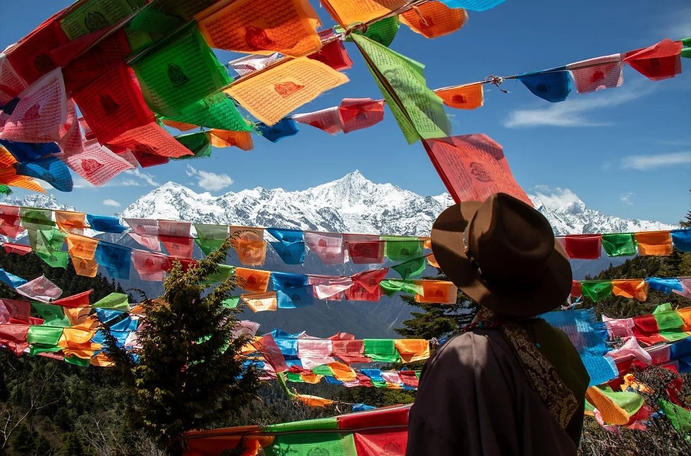
North of Deqin the road climbs toward Feilai Temple at 3,300 metres, and there the Kawagebo massif rises to 6,740. It has never been climbed: local regulations prohibit summit attempts, and the mountain has been closed to them since the 1991 avalanche that killed seventeen members of a joint expedition. What remains open is the walking, which is the most atmospheric Yunnan hiking in the province: from Xidang at 2,200 metres, up over the Nanzong pass at 3,700, down into Yubeng at 3,100, then out to the Sacred Waterfall at 3,600 or Ice Lake at 3,900.
This zone is where altitude and remoteness combine, so Yunnan hiking here needs slack in the schedule. A road now reaches Yubeng, which has changed the character of the approach, but the side valleys remain walk-only and the weather can close the pass without warning. Four to six days is the honest Yunnan hiking allocation. Village guesthouses are simple, cash still matters, and the nearest hospital with meaningful capacity is in Deqin or back in Shangri-La, which is a long drive from anywhere on this route.
Gaoligong, forest walking with a permit desk
The Gaoligong range along the Myanmar border is the other Yunnan hiking landscape: no snow, no exposure, and a vertical forest that runs from subtropical riverbank to alpine ridge within a day's walk. Around Baihualing in Baoshan, trails sit near 1,500 metres among some of the richest bird habitat in the country, with hides, village guesthouses and a checkpoint that registers visitors before they enter. Yunnan hiking here is moderate; the humidity is not, and from May to September the leeches are a genuine planning consideration rather than a joke.
Permit rules here are the model for how Yunnan hiking access actually works: the range is managed in sections, and closures for fire risk or wildlife protection apply section by section rather than province-wide. A closure on the Gongshan section in winter does not close Baoshan, and a registration requirement at one checkpoint is not the same rule as the next. Call the specific management station for the specific Yunnan hiking trail, and treat any general statement about the mountain as a starting point only.
Yuanyang and Jingmai, walking through working landscapes
In the south, Yunnan hiking becomes cultural geography. The Hani terraces around Yuanyang, inscribed by UNESCO in 2013 and still farmed by roughly 82,000 households, sit between 1,400 and 2,000 metres and are walked on stone steps built for irrigation maintenance rather than for visitors. Duoyishu, Bada and Laohuzui are the three viewpoints most walkers use as anchors, and Azheke is the village where the mushroom houses are still lived in. Jingmai Mountain in Pu'er, inscribed in 2023 as a tea landscape, is a forest of ancient tea trees with nine villages and trails of two to four hours between Nuogan, Wengji and the tea-forest core.
Neither is wilderness and neither should be treated as a Yunnan hiking trail network. You are walking through somebody's inheritance, on paths that carry water, compost and harvest, and the etiquette is correspondingly specific: do not walk terrace walls, do not enter a courtyard uninvited, give way to anyone carrying a load. Gradients are modest and the difficulty is entirely in the surface and the heat, which is why these Yunnan hiking zones suit travellers for whom altitude is a medical rather than an athletic question.
Jinuo and Bulang hills, the tropical Yunnan hiking option
Around Jinghong the elevation drops to 550 metres in the city and 600 to 1,100 on the surrounding hills, which makes this the lowest and wettest Yunnan hiking country in the province, and the forest changes to something that behaves like Southeast Asia. Trails in the Jinuo hills and around Bulangshan are short, humid and biologically dense, with fig trees, bamboo and leeches, and they are usually walked with a local guide who knows which ridge leads back to a road. Heat is the dominant constraint: a three-hour walk here can cost more fluid than a full day on the plateau.
This is the Yunnan hiking zone to choose when the calendar is fixed to July or August and altitude is off the table. Rain arrives as heavy afternoon showers rather than as a season, trails dry quickly, and the forest is at its most alive. The trade-off is that leeches, mosquitoes and slick clay are guaranteed rather than possible, so gaiters, quick-dry footwear and a change of socks belong in the pack for any Yunnan hiking day here.
Transport and Solo Ability: The Two Filters Nobody Scores
Yunnan hiking logistics have improved faster than most guides admit. High-speed rail runs from Kunming to Dali in about two hours, on to Lijiang in another two, and north to Shangri-La since late 2023 in roughly eighty minutes from Lijiang. A separate line drops south through Pu'er to Jinghong in about three and a half hours, and the western line reaches Baoshan in around four. That network covers the approach to five of the seven Yunnan hiking zones; what it does not cover is the last thirty kilometres to any trailhead.
The pattern to plan around on any Yunnan hiking trip is rail to a hub, then a hired vehicle to the trail. Lijiang to Qiaotou, the start of the Tiger Leaping Gorge walk, is roughly 100 kilometres and two hours by bus or van. Shangri-La to Deqin is about 190 kilometres on the G214 and takes three and a half to four hours in good weather and considerably longer after rain. Tengchong and Baihualing are reached by road from Baoshan. Yuanyang is a six to seven hour bus from Kunming with a change at Jianshui or Gejiu, which is why many Yunnan hiking parties break the journey overnight.
Driving yourselves is possible and occasionally excellent on Yunnan hiking routes, but the G214 north of Shangri-La and the Nujiang corridor are not roads to learn on. Rockfall, cattle, overtaking on blind bends and summer landslide repairs are the normal condition, and night driving outside towns is best avoided. A car with a driver for Yunnan hiking runs roughly 600 to 900 yuan a day depending on distance and season, which is often cheaper than expected once parking, fuel and one wrong turn are counted.
Solo Yunnan hiking works well in specific places and badly in others. Tiger Leaping Gorge, Cangshan, the Yulong day walks and the Jingmai tea-forest trails all have enough traffic that a turned ankle would be found within an hour. Yubeng in winter, the upper Haba approach, the Dulongjiang road and most Bulangshan side valleys do not. The test is not courage but consequence: if the only person who would notice you are late is a guesthouse owner who has not seen you, and the only exit is the way you came, you are not on a solo trail, you are on a trail alone.
Permits and registrations are the quiet gatekeepers of Yunnan hiking access. The Meili scenic area is ticketed and Yubeng sits inside it. Gaoligong checkpoints register visitors by name and number. Haba requires registration and a licensed guide, checked at the trailhead. Yulong and Cangshan charge entrance and cable-car fees separately. None of this is difficult, but all of it is local, and all of it can change with a fire ban or a wildlife closure, so confirm the specific Yunnan hiking rule for the specific trail rather than the general rule for the mountain, which is the recurring shape of access in this province.
For solo travellers who want company without a group, the Yunnan hiking guesthouse network does the work. In the gorge, walkers converge at the same four or five houses each evening and routes get compared over dinner; on the tea-forest trails, village guesthouses will pair you with a guide heading the same way. Arriving with a plan and leaving room to change it is the practical version of solo Yunnan hiking, and it is also the version that produces the best decisions when the weather turns.
One further number is worth holding in mind when judging how crowded a Yunnan hiking route will be. Yunnan received 990,000 inbound arrivals by 1 August 2026, of whom 819,700 entered visa-free, or 82.8 percent, and small-group tours with no shopping stops now account for 73 percent of bookings while discounted shopping tours fell 19 percent. The practical effect on Yunnan hiking is that the popular trailheads are busier in the shoulder months and quieter in the wet season, and that the market has shifted toward exactly the kind of low-volume, high-information trip that walking rewards.
Live Verification: What to Check Before Yunnan Hiking Starts
Every plan contains assumptions that expire. Trails close for fire risk, roads close for repairs, guesthouses shut for the winter, buses change their departure point, and a gate price printed in a guidebook two years ago is now a negotiation. The only reliable method is a three-stage check for any Yunnan hiking week, run at seven days, at forty-eight hours and on the morning itself, with different questions at each stage.
Seven days out, the Yunnan hiking questions are strategic. Is any forest area on the intended route under a fire ban or wildlife closure? Are the roads open, particularly on the Nujiang, Dulongjiang and G214 corridors? Has the seasonal weather pattern arrived early or late this year? Provincial forestry and culture-tourism notices, county government accounts and the scenic area accounts on WeChat carry this information, usually in Chinese and usually a few days before it affects you. This is also the moment to decide whether to hold a lower-elevation Yunnan hiking alternative, because deciding under pressure is worse.
Forty-eight hours out, the Yunnan hiking questions are local and specific, and they should go to a person. Call the guesthouse you intend to sleep in and ask three things: is the trail open, is the stream at the trailhead crossable, and has anyone walked it in the last two days. Guesthouse owners in Yunnan hiking country are the most accurate information source in the province because their business depends on knowing. The same call tells you whether they are open at all, which is not a trivial question outside the main season.
On the morning of a Yunnan hiking day, the questions are physical. Read the notice board at the trailhead, register if there is a register, look at the sky in the direction you are going rather than overhead, and look at the river. Brown, rising water means rain fell somewhere upstream overnight, which matters more than whether it is raining where you stand. If the board says closed, the board is right, and no amount of travel to get there changes that. The notice board outranks every article about the trail, including this one.
Reading a Yunnan hiking forecast is its own skill. Convective rain in Yunnan arrives in the afternoon and clears at night, so a forecast of thunderstorms often means a dry morning and a wet 3 p.m. A forecast for the county seat is frequently wrong for a ridge 1,000 metres above it, and a forecast of clear skies says nothing about cloud forming on a summit by mid-morning. The useful habit is to plan the exposed Yunnan hiking section for the morning and to treat the early afternoon as the point after which you want to be descending.
Verification applies to people as well as places. A Yunnan hiking guide should be able to show a guide licence tied to a registered travel company, and a driver should have a commercial vehicle permit, both of which matter for insurance as much as for competence. Prices quoted for Yunnan hiking on the spot are normal and negotiable; a refusal to discuss insurance, route or turn-around time is not. In our own planning, a Human-designed Travel itinerary is only signed off once the local operator has confirmed the current trail and road status in writing, because that conversation is where most surprises are caught.
When | What to check | Where |
Seven days | Fire bans, forest closures, road status | Provincial forestry and tourism notices |
Forty-eight hours | Trail open, stream level, recent traffic | The guesthouse you booked |
Morning of | Notice board, register, sky, river colour | The trailhead itself |
On the day | Guide licence, vehicle permit, insurance | In person, before departure |
Turn-Back Rules for Yunnan Hiking
Turning back is the skill that separates a long walking life from a short one, and it is almost entirely a matter of deciding in advance. The reason is well known and still underrated: the further you have come, the more it feels like the remaining distance is owed to you. Every rule below exists to move the decision out of that Yunnan hiking moment and into a calmer one, ideally over breakfast.
- The time rule: name a turn-around time for every Yunnan hiking day, not a destination. If the clock reaches it, you turn, whether or not the high point is ten minutes away. Ten minutes is how the afternoon gets lost.
- The altitude rule: above 3,000 metres on any Yunnan hiking route, a headache with nausea, vomiting or unsteadiness ends the ascent and starts the descent. Do not spend a night at the altitude where symptoms began.
- The water rule: never cross a stream on a Yunnan hiking day when it is rising or opaque. Rain two valleys upstream is invisible from where you stand, and the crossing you managed in the morning may not exist by mid-afternoon.
- The visibility rule: if you lose the ridge or the path in cloud on unmarked Yunnan hiking terrain, stop and go back down the way you came rather than traversing to find it. Traversing in cloud is how people walk off the wrong side.
- The check-in rule: tell one person your Yunnan hiking route and the hour you will message them, and make the message the deliverable. If they have not heard by the agreed time, they call the guesthouse, not the police.
- The group rule: on any Yunnan hiking day the slowest person sets the pace and anyone may call a turn without justifying it. Groups fail on trails like these not because someone is unfit but because nobody wants to be the one who says so.
The hardest Yunnan hiking version of this is the sunk-cost turn, the one that happens two hours above the last village with the summit in view. Guides in the gorge and on Haba describe the same pattern repeatedly: parties that turn at the fixed time are the ones who come back the following year, and parties that push for the top are the ones who arrive after dark or not at all. The mountain does not record your intention, only your position at dusk.
Solo walkers need a stricter version of these Yunnan hiking rules, because nobody will argue with them. Fix the turn-around time in writing, send it to somebody, and give yourself a rule that requires no judgement in the moment: if two of the three conditions - time, weather, body - have deteriorated, you turn. This removes the need to assess whether the situation is bad enough, which is precisely the assessment people get wrong when they are tired.
Finally, decide what a good Yunnan hiking turn-around point looks like before you need one. A col, a stream junction, the last tree line, the far side of a landslide, the point where the path stops being a path: these are places where turning is clean and obvious. Turning at a feature is far easier than turning at a number, and on a route you have not walked before, the feature is often the only thing you can recognise in bad weather, which is why a Human-designed Travel day sheet names one.
Low-Impact Practice on Yunnan Hiking Trails
Most of these trails are not wilderness areas. They are working land with a thin layer of tourism on top: irrigation paths, livestock routes, tea-forest tracks, village lanes. That single fact reorganises the ethics of Yunnan hiking. The question is not how to leave no trace in an empty landscape but how to pass through somebody's working life without making their day harder or their land poorer.
Waste first, because it is the most visible Yunnan hiking failure. There is no bin network above the villages, and the people who carry rubbish down are the guesthouse families who already carried the supplies up. Everything you bring should leave with you, including wet wipes, tissues, fruit peel and the plastic wrap around a snack. On high routes where burial is impossible, the honest option is a sealed bag in the pack. Burning or burying rubbish on the plateau is not a solution; the ground is cold, the decomposition is slow, and animals dig it up.
Human waste on a Yunnan hiking route needs a rule rather than a hope. Below the tree line, a hole 20 to 30 centimetres deep at least 60 metres from water, paths and buildings, with the paper carried out, is the standard. Above the tree line, in the gorge and on the Haba approach, there is no soil to dig into and the correct answer is to carry it out. Guesthouses along the popular routes increasingly provide this expectation explicitly, and the ones that do deserve the booking.
In the terraces and tea forests, Yunnan hiking impact is measured in damage to a crop rather than in litter. Do not walk on terrace walls, which are the structure that holds the water; do not cut across a planted plot to save a bend; do not pick tea, even from a tree that looks wild, because in Jingmai the ancient tea forest is a harvest and a household's income. Ask before photographing people, accept a no without negotiating, and if a household offers tea, buy something rather than simply accepting.
Wildlife rules on Yunnan hiking trails differ from park rules because there is no ranger at the boundary. Drones are prohibited in scenic areas and are a serious irritant near nesting birds, which is the main reason Gaoligong hides exist at all. Village dogs hurt more walkers than anything else here, and the correct response is to stop, stand still and let the dog lose interest rather than run or swing a pole. Livestock gates should be closed behind you, and animals on the path should be given the outside line rather than pushed.
Rangers in the border counties now monitor wildlife that has moved closer to settlements, which changes how to behave on any Yunnan hiking route that passes a village. Their guidance is worth repeating: report sightings rather than pursue them. Xiong Qinggang, station chief at the Bingzhongluo management station of the Gaoligongshan national nature reserve, said in June 2026 that a first record of glossy ibis near a residential area reflected an improving ecosystem and that monitoring and public education measures had been put in place around the location. The same logic applies to any rare species you meet on a trail: the sighting is data, and the chase is damage.
The last low-impact Yunnan hiking decision is economic. Hiring a local guide, sleeping in a village guesthouse, eating where the family eats: these are the mechanisms by which a trail becomes worth protecting to the people who live beside it. In the gorge, in Yubeng, in the tea villages, the difference between a route that is maintained and one that is not is usually whether walking pays. That is not sentiment. It is the most durable conservation instrument available on a trail without a management plan, and it is the part of Human-designed Travel that cannot be delegated.
Assembling a Yunnan Hiking Week by Profile
Three profiles cover most of the demand, and all three are built backwards from a turn-around rather than forwards from a map. The point of the three Yunnan hiking templates below is the sequence of exposure: each one adds altitude only after the body has had a night to adapt, and each keeps a spare day that can be spent on weather rather than on transport, which is the whole logic of a Human-designed Travel week.
The first-week Yunnan hiking profile, five to six days, low altitude and no ambitions above 2,700 metres: two nights in Lijiang to acclimatise at 2,400, the two-day Tiger Leaping Gorge traverse, then a recovery day in Dali with the Cangshan contour path as an optional add. This is the Yunnan hiking version to choose with children, with a mixed-ability group, or on a first visit. The gorge provides the drama, the altitude stays honest, and the transport is all under three hours.
The altitude-build Yunnan hiking profile, eight to nine days, for walkers who want high ground without a summit: Lijiang for two nights, Shangri-La for two at 3,300, a day at Pudacuo between 3,500 and 4,000, then Deqin and the Feilai Temple viewpoint at 3,300, with a walk toward Yubeng or along the valley floor depending on how the body has behaved. Yulong can be added at the start or the end, but not on the day after a 3,300-metre night, because the cable car to 4,506 is the least forgiving ascent in the province.
The remote Yunnan hiking profile, ten to twelve days, for experienced walkers: gorge first as a shakedown, then north to Deqin, three to four days in and around Yubeng including the Sacred Waterfall and Ice Lake, and a buffer day at the end. This is the only profile where Yunnan hiking genuinely requires a guide, not for navigation but for judgement on the pass and for the vehicle that has to wait when weather changes the schedule. It is also the profile most often cut short by a flight home, which is why the buffer day belongs at the end rather than in the middle.
Costs for Yunnan hiking sit in a narrower band than most people expect, provided the trip is not built around peak holiday dates. A week of gorge and Cangshan walking for two people, with a driver and one guide, usually lands between 6,000 and 9,000 yuan each before flights. The Yunnan hiking cost table below reflects what we quote and re-check each season; treat the figures as ranges to sanity-check against your own operator rather than as a price list, and confirm anything involving a gate or a cable car on arrival.
Item | Typical cost | Note |
Guesthouse room, gorge or village | 80-250 yuan a night | Cash still useful outside towns |
Licensed guide | 400-800 yuan a day | Higher for snow terrain |
Pack horse | 200-400 yuan a day | Common on the Yubeng approach |
Car with driver | 600-900 yuan a day | Cheaper than two seats on many routes |
Shared van, last leg | 30-80 yuan a person | Confirm the day before |
Entrance and cable car | 45-220 yuan a person | Changes with season and ticket type |
Frequently Asked Questions
Q1. Is Yunnan hiking safe for someone travelling alone?
Yunnan hiking is safe alone in the gorge, on Cangshan, on the Yulong day walks and in the Jingmai tea villages, with ordinary care: those routes carry enough traffic that a problem gets noticed. In winter on the Haba approach, in remote side valleys and on single-exit trails, no. The test is whether anyone would notice you had not arrived, and whether there is a second way out.
Q2. What is the best month for a walking trip here?
The best Yunnan hiking window is late September to late October, across all elevations: the rain has retreated, the air clears and temperatures are moderate. Late April to May is the second choice, with green slopes and rising rivers. July and August are workable on the plateau but punishing on unsealed descents, and the tropical south is at its wettest.
Q3. Do I need a guide?
For Yunnan hiking at Tiger Leaping Gorge, Cangshan, the tea-forest trails and most day walks, no. For Haba, yes, and it is a legal requirement rather than a preference. For multi-day routes in Deqin and for anything in winter, a guide is less about navigation than about judgement and about having a vehicle that waits when the weather changes.
Q4. How fit do I need to be?
Yunnan hiking in the gorge asks for the ability to walk six hours with 800 metres of gain and do it again the next day. For terrace and tea-forest walking, the same hours at half the gain but a worse surface. For anything above 3,500 metres, fitness helps less than acclimatisation does, and a person who arrives slowly will outperform a fitter person who arrives fast.
Q5. What happens to the trails in the rainy season?
Yunnan hiking stays open on the plateau but changes character: slick clay, greening on stone, afternoon storms on ridges and leeches in the tropical south. Rivers rise and road repairs slow the Nujiang, Dulongjiang and G214 corridors. Build in one contingency day per three days of walking, and cross streams in the morning.
Q6. Are there permits or registrations?
Registrations exist, and each one belongs to a different authority, which is the most useful single thing to understand about Yunnan hiking permits. Expect a ticket for the Meili scenic area that covers Yubeng as well, a name-and-number entry at Gaoligong checkpoints, a registered guide for Haba, and separate entrance and lift charges at Yulong and Cangshan. Fire bans and wildlife closures override all of it, so ask about the exact path rather than the mountain.
Q7. Will I get altitude sickness in Shangri-La?
Yunnan hiking at 3,300 metres gives some people a headache or poor sleep, especially if they arrive from Kunming in a single day. The fix is unglamorous: two nights at 2,400 metres first, no alcohol on arrival, and a slow first day. Symptoms that include vomiting, confusion or breathlessness at rest mean descending, not resting.
Q8. Is winter a reasonable time to walk?
For Yunnan hiking below 2,500 metres, yes: dry, clear and quiet, with cold nights. Above 3,000 metres, winter means snow on approaches, short days and unheated rooms, and some guesthouses close. The tropical south is at its best from December to February, which makes it the obvious alternative when the calendar is fixed to midwinter.
Q9. What should I carry that people usually forget?
The Yunnan hiking items people forget are cash in small notes, a head torch, a waterproof layer that works in wind, and a written turn-around time. Add gaiters and a spare pair of socks for the tropical south, and a sealed bag for waste on any route above the tree line. Phone signal exists on far more trails than visitors expect, which makes it easy to over-rely on it.
The argument of this page is not that Yunnan hiking is difficult. Most of it is a walk, and a very good one. The argument is that the decisions which decide whether a walking week works are made before the trailhead and above it: which month, which elevation you sleep at, whether the last thirty kilometres are actually covered, and what would have to be true for you to turn around. Get those four right and the province is unusually generous. Get them wrong and no amount of fitness rescues the week.
That is also the difference between a route that exists on paper and one that holds up in the rain. It is the test any Yunnan hiking week eventually applies. Human-designed Travel means the itinerary is shaped around the person walking it, the month they are walking in and the information available that morning, rather than around a list of viewpoints. If a trail is closed, the plan changes; if the stream is up, the plan changes; if somebody is breathing hard at 3,300 metres, the plan changes and nobody is asked to apologise for it.
Walk it in the shoulder season, sleep low, verify locally, turn early, and carry out what you carried in. Those five habits cover almost everything a first Yunnan hiking season can throw at you, and they are also the reason a second season follows.
Sources and Fact-Check Trail
- Yunnan Provincial Culture and Tourism Department, inbound arrivals and visa-free entry figures, 1 August 2026.
- Yunnan Provincial Forestry and Grassland Administration, seasonal forest fire bans and area closures, 2026.
- UNESCO World Heritage List, Cultural Landscape of Honghe Hani Rice Terraces (2013) and Cultural Landscape of Old Tea Forests of the Jingmai Mountain (2023).
- Gaoligongshan National Nature Reserve, Bingzhongluo management station, statement by station chief Xiong Qinggang, June 2026.
- China Railway Kunming Group, Lijiang-Shangri-La and Kunming-Jinghong service information, 2026 timetable.
- Prefecture and county government notices on road status for the G214, Nujiang and Dulongjiang corridors, 2026.
- Field checks by Kiki Holidays guides on Tiger Leaping Gorge, Haba, Cangshan, Yubeng, Baihualing, Yuanyang and Jingmai, 2025-2026 seasons.


Comments